The Parish of Burgh-by-Sands
The Parish is a scenic, historic and rural area located on the Solway Coast, approximately 5 miles west of the City of Carlisle, in the very North-West of England.
A Map of the Parish of Burgh-by-Sands
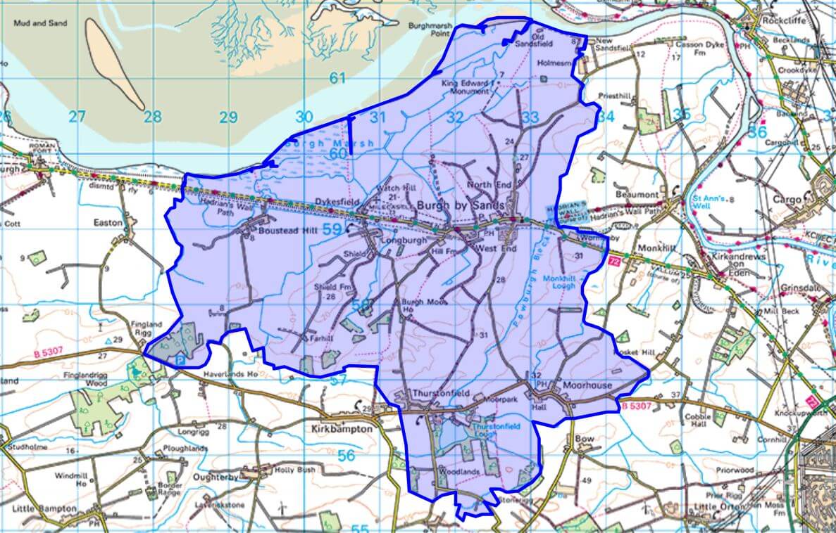
The Parish includes the larger village of Burgh-by-Sands with the further villages of Moorhouse, Thurstonfield, Longburgh, Dykesfield and Boustead Hill. According to the 2021 census the Parish population was 1,217.
There are 55 listed buildings within the Parish; one is listed at the highest Grade I (St. Michael’s Church in Burgh-by-Sands), three are listed at Grade II* (one of which is the Edward I Monument on the marsh), and the remainder at Grade II.
As well as the Parish Hall, Burgh-by-Sands has a Primary School, a Public House and a Post Office. The Hadrian’s Wall Path and the Hadrian’s Cycleway (NCN Route 72) both pass through the village.
The Hall, originally built in 1894, is now owned by a local community charity (No. 230483) and is managed by the Parish Hall Management Committee. It is held in trust for the use of the inhabitants of the Parish without distinction of sex, political, religious or other opinions.
If you are interested in the Parish Hall, you’re more than welcome to come along to one of our Committee meetings, the dates of which always appear on the What’s On page. If you’d like to join us as a volunteer, to help organise and run events, or to maintain and develop the hall then we’d be very pleased to hear from you – either come to one of our Committee Meeting or see our Contact Us page for how to get in touch.
We have many Regular Events in the Hall that you’re more than welcome to attend.
Here you can see our programme of Upcoming Events.
You can view the full Hall Diary to see what events are held on each day and when the Hall or meeting rooms are available to hire.
This is how to Book the Hall or a Room.
This is our Constitution.
 Village Map